Saturday, February 25, 2017

The Culvert under Milton Line Revisited

Earlier I visited to and did find another dry rail bridge through which Jackson Creek once flown.  Unfortunately, it was inhabited.  Travelling through the area, I decided that since it was colder now, Greg might have moved out to a place with more walls (or Vancouver), so I decided to get a better glance.


While the creek was flowing, the railway had only two tracks.  Therefore the original entrance is from the north side.  When the rail bodies added extra tracks, from the south side, they simply inserted a pipe to continue the culvert.  

Being quite belligerent with my safety, I hopped right down.  This time there was no date stamp, unlike at the Canpa bridge.  Also, unlike with the Canpa bridge, I did not venture further down, since it was dark inside and potentially still inhabited.


I also noticed that across the fence, the dry bed continued.  I decided to investigate.


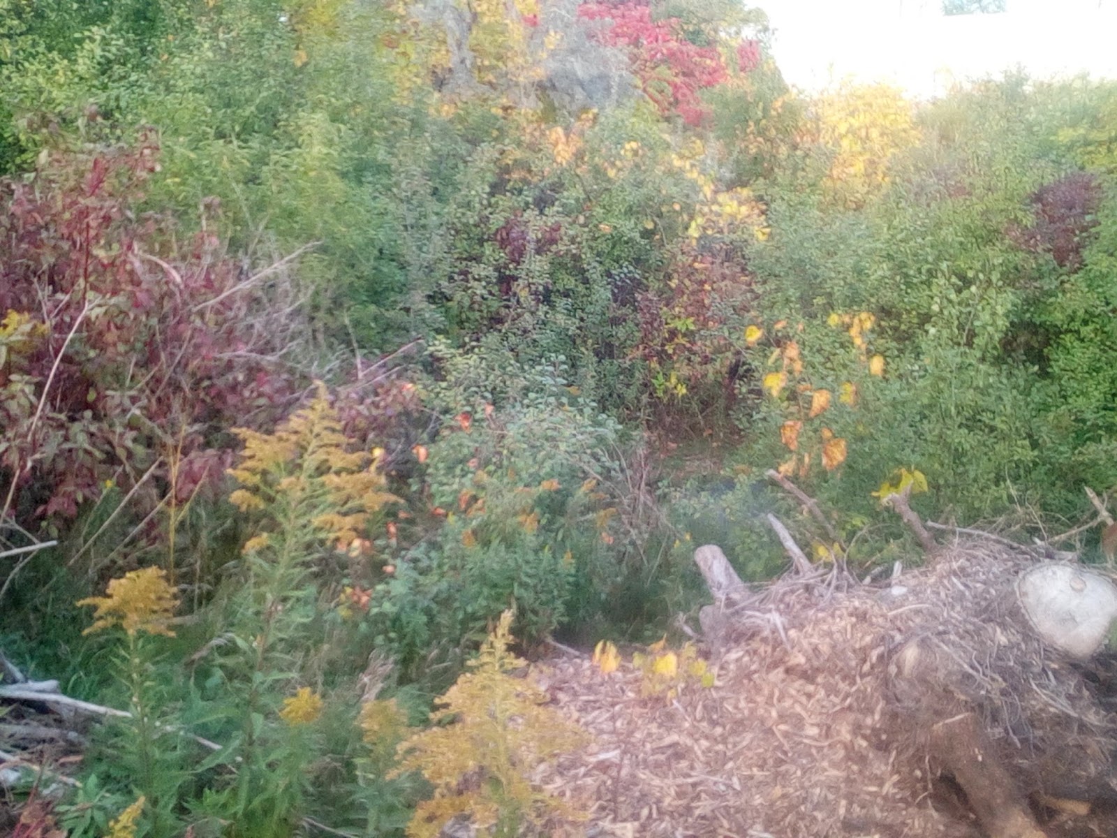
The dry bed is crowded with brush and trees; there appeared to be be some sort of concrete formation down there too.


As you can see from above photo, I decided to descend down the dry bed.


I hiked up to the concrete structure and was met with, presumably Greg, who was understandably unhappy.  I then went on with my day.


Thursday, January 12, 2017

Alderwood Collegiate Institute Erased with Jackson Creek as a Bundle

Once upon a time there was a high school that allowed Jackson Creek to flow freely through its property.  Also once upon a time there were city/government officials that demanded out of developers at least one lot allocation for parkland.

Right now the impugned city official for Etobicoke-Lakeshore displays lack of ethics (2) when it comes to developer relations.  In fact South Etobicoke is famous for such hanky-panky (2).  That's how we end up with a final design over a new block that erases any public green space or traces of natural heritage that was there and maximises the plots for developers:


Jackson Creek flowed through the school grounds as follows from an aerial photo:


Up until recently there was come green space on the creek bed favoured by dog walkers.


Now it is all dug up in the implementation of the plan above:


Predictably the water pools where the creek used to flow, as it lies on the landscape formed by Jackson over millennia before the planners decided to delete it.


Jackson Cleek flowed through the pipes unearthed during construction in order to provide access to the school's parking lot.  There is a much longer pipe buried under the road to the south.  

Alderwood Collegiate Institute can also be remembered though these pictures.  The abandoned building was even visited by some fat positive photography troupe.

The development got about 40 seconds of official time by TRCA in regards to Jackson Creek (Page3 Section 8).  Kudos.  Their request is filed with the city.  Their efforts were in complete vain, as can be seen with the final development plan. Predicted fruits, given the ways and practices of the governmental officials. 

At least the elementary schools to the north gets to keep its green-space for now.  It features a culvert collecting with Douglas Park (Just Add Water) and a dry bed.  


Curiously, the groundskeeper crudely capped the culvert from Douglas Park with concrete.  Maybe the inflow of water was unwelcome without a proper further outlet.

Here is a view of the pigeonhole development from the north.

There aren't too many areas where Jackson Creek may be daylighted.  Looks like this sliver of land was lost forever in favour of 15 houses crammed like sardines along a former schoolyard's edge.

Editor's note:  this is me completing the backlog/ drafts of the project.  Unfortunately, the owner of the idea retired this blog and soon enough we will be archiving this 'act local' neighbourhood project towards more abstract, inconsequential, academic, 'act global' movements that is normal for the people these days to get behind (like being a Global Warming believer and sharing/ subscribing what politicians/ celebrities say about it).  If someone want to pick up on this thankless task, feel free to use/ re-purpose the contents of this blog.

Last 'Waterside' 'House'

Recently I've found two (1) (2) lost bridges of Jackson Creek.  There is another quasi-government real estate magnate that tends to abandon its property, Toronto Hydro.  Jackson Creek lucked out to have its former bed running through one of TH's inconspicuous residential substations.


Adjacent residential properties obviously fattened/ filled-in their lots.  Since TH does not really enjoy or care about the quality of their backyards, it left the bed to the force of gravity to year-after-year flatten the ravine, erasing the millennia of water erosion by the living flowing water that got engineered away by the city.


When the creek flowed, it unearthed a glacier boulder that is now slowly sinking back into the grass, that the landscaper for TH evidently employs diligently mows.  Also there stands a middle-aged willow that might have started its life as a waterside tree, as they tend to.  It might just remember Jackson Creek flowing, even though most of us were denied that joy of an experience.

Above is an aerial photo of the area in 1969, when Jackson Creek flown and carried life through the area.


You may note that there is a point to the north of the neighbourhood where the creek was flowing parallel to the road for a bit.  There, the course was filled, yet the sidewalk was never laid.   At the spot where the creek dashed again towards the lake (south) the fence is leaning in the direction of the former flow.

Editor's note:  this is me completing the backlog/ drafts of the project.  Unfortunately, the owner of the idea retired this blog and soon enough we will be archiving this 'act local' neighbourhood project towards more abstract, inconsequential, academic, 'act global' movements that is normal for the people these days to get behind (like being a Global Warming believer and sharing/ subscribing what politicians/ celebrities say about it).  If someone want to pick up on this thankless task, feel free to use/ re-purpose the contents of this blog.

Thanks For Reading 

Correction: The location in the aerial photo is off by one house.  In the correction the area with the missing sidewalk is in orange. Jan 2017


Sunday, October 16, 2016

Another Rail Bridge: People Living the Creek

I was at this location a year ago.  Unfortunately, I lost my phone with all the pictures and videos before I could produce a post.

Jackson Creek was lucky enough to flow, where there's now a junction of a rail line and a power transmission corridor.


This section of shrub-land may also see some  transformation, being in the cross-hairs for GO Transit as a station.

There are two channels on the lot that reflects the former course of the creek in 1947.  It seems that the creek was switching back and forth between the beds.


The east channel is full of quite old trees.  Stepping down (5-6 feet) seemingly transports you to any tract of York Regional Forest.

Looking over the dry channel facing East Mall
Since the last time I was there, the West channel got taken over by blackberry thorn-brush and grapevines.


The biggest change was the absence of mini lake/ wetland that was right below the culvert where the creek used to come out. There are still remnant of a pretty awesome dock that was there.  The dock is a strong evidence of a need for more green-space/ natural heritage for people to interact with.  It is somewhat clandestine, but since the city does not provide by collaborating with wiping out of entire ecosystems and turning South Etobicoke into a concrete post-industrial jungle, then who can blame the developers of the dock.  Plus they kept it super tidy.


The lack of water certainly surprised me.  Of what I remembered too, was that you could see through the culvert to the other side.  I was assuming that it was to some sort of vertical drain at the Food Basics/ Metro property across.  


WARNING  While it is a popular local practice to cross and use this rail line for pedestrian purposes, the tracks are still used for freight and a limited GO Service.

I carefully went across the lines in the name of science and conservationism.  To my surprise, I discovered a bridge, much like the one at Horner.  However this one is in much better condition and seemed to be freshly excavated. 

I was about to jump down, but a friend of Jackson Creek, Greg (name changed), popped out from under.  He admitted to live there, yet did not seem too talkative.  Since no one likes to be an uninvited guest, I wished him to have a nice day and started to track back, as the sun was setting. 


Below is some sort of industrial facility, now decommissioned and for lease.  


At the East Mall end of the lot lies a manhole that may shield the waters of the creek being piped away.


It is nice to see a culvert, a bridge and a bed still being preserved.  Just add water and everyone may enjoy new access to the outdoors and the special experience of watching living water flow.  Well, maybe not Greg. 


Please join the movement and contribute at https://friendsofjacksoncreek.slack.com/home 


Update: I managed to recover pictures from my earlier vision.  That was before Greg capped the culvert.